About this service
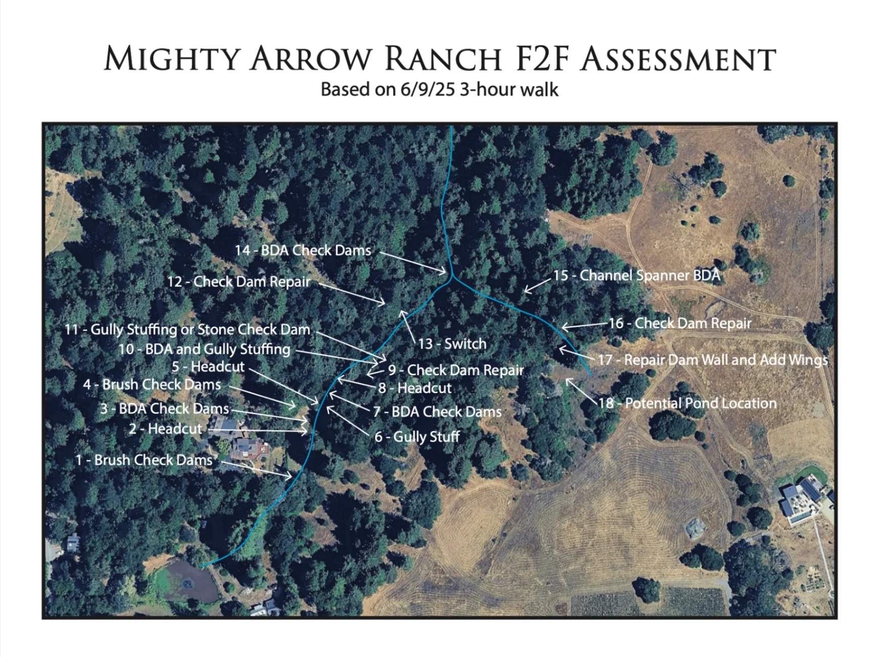
Precise location data transforms field observations into powerful design tools. Our geotagging services use GPS technology to accurately mark and document key site features, creating a comprehensive digital inventory of your landscape. We identify and map gullies, creeks, rivers, and other water features with precise coordinates, catalog existing plant species with their exact locations, and document significant landscape elements that influence design decisions. All geotagged data integrates seamlessly with base maps and digital design software, ensuring that field observations directly inform and enhance the design process with location-specific accuracy.